Wintry Weather Blankets New England and California Mountains as Storm Expected in Central Regions
- Published In: Other News & Features
- Last Updated: Mar 26, 2024

Winter returned to the Bismarck Mandan with snow covering the area slowing commute times for people walking and driving., Thursday, March 21, 2024 in Bismarck, N.D. Parts of Montana, the Dakotas, Minnesota, Illinois and Wisconsin are under winter weather advisories, with snow expected to start falling Thursday in some areas. Minnesota could see a foot of snow over the weekend, and parts of New England could also see 12 to 18 inches (30 to 45 centimeters) in the coming days. (Tom Stromme/The Bismarck Tribune via AP)
BY STEVE LEBLANC
BOSTON (AP) — It may officially be spring, but wintry weather blanketed the U.S. on Sunday with New England and California seeing a mix of rain, hail, heavy snow and gusty winds.
Near Los Angeles, a severe thunderstorm warning was issued through the afternoon, with the National Weather Service predicting scattered showers, quarter-sized hail and wind gusts approaching 60 mph (97 kph).
The California storm was moving south from the Sierra Nevada, where areas around Lake Tahoe received about a foot (30 cm) of new snow and Mammoth Mountain reported up to 18 inches (45 cm) by Sunday morning. A day earlier, the resort was forced to close several ski lifts after a 91-mph (147-kph) wind gust was recorded.
A winter weather advisory was issued through Sunday night for parts of northern Arizona, the Grand Canyon and Flagstaff to the New Mexico border with up to a half foot (15 centimeters) of snow possible at upper elevations and winds gusting to 40 mph (64 kph).
The National Weather Service also warned of what it called a significant winter storm over central regions of the country through Monday.
“The winter storm will be high-impact and an extensive system producing widespread heavy snow and gusty winds that will persist over parts of the Northern Plains and Upper Midwest,” the agency said in an online post.
Heavy snow is expected to spread across central and eastern Montana and expand into the northern Plains and upper Midwest through Sunday and into Monday. There is a greater than 70% chance of at least 8 inches (20 centimeters) of snow moving from central South Dakota to northeastern Minnesota and northwestern Wisconsin, the weather service reported.
In Maine, the National Weather Service warned of treacherous travel with an increase in ice forming inland from the coast, on top of snow or sleet that had already fallen.
Farther inland, forecasters called for anywhere from 1 to 2 feet (30 to 61 centimeters) of snow across the mountains in western Maine and areas north and in New Hampshire’s White Mountains, according to Maura Casey, a lead forecaster for the weather service, based out of Gray, Maine.
In the lakes region of New Hampshire up to Maine, totals were expected to be somewhat lower at 6 inches to a foot (15 to 30 centimeters) with sleet and freezing rain mixing in.
Across Connecticut, New York City, Rhode Island and Massachusetts, the storm was expected to remain largely a rain event.
“Overnight dry weather will give way to sunshine,” said Frank Nocera, lead forecaster for the National Weather Service in Norton, Massachusetts. Despite the sun, Sunday was expected to be blustery with temperatures chillier than average for late March, he said.
In New York City, a flood watch and wind advisory were in place until 2 a.m. Sunday.
Flooding impacted subway service and shut down a section of the Staten Island Railway in both directions. Flooding also closed part of the Cross Island Parkway in Queens, and police warned motorists about standing water on roadways throughout the city.
The storm was blamed for hundreds of delayed and canceled flights at New York-area airports, and it also postponed the opening of Coney Island’s Luna Park, home to the famous Cyclone and Thunderbolt roller coasters.
Fans of skiing welcomed the snowfall.
At Loon Mountain in New Hampshire’s White Mountains, skiers were looking forward to the 12 to 20 inches (30 to 51 centimeters) of new snow the storm was expected to drop on top of a foot (30 centimeters) earlier this week.
“The storm is great. It’s brought a lot of skiers out to the mountain today,” said Kevin Bell, vice president of marketing for the resort. “This could be the biggest snow we’ll see all year. It sets us up for a really good spring. The more snow New England gets, the better for us.”
The Mount Washington Avalanche Center issued an avalanche warning along the White Mountain’s Presidential Range until 7 a.m. Sunday.
“Very dangerous avalanche conditions exist. Natural and human-triggered avalanches large enough to bury people are very likely,” the center said. “Some avalanches will be large enough to snap trees or destroy a house and may run far into areas previously considered safe.”
The storm should be completely out of the New England region by Sunday morning. It comes at the end of a winter season in some areas of the Northeast, including Boston, that saw little snow and warmer temperatures.
In South Florida, severe thunderstorms Friday night delayed departures at the Miami International Airport during the busy spring break season, suspended a popular electronic music festival and disrupted matches at a high-profile tennis tournament.
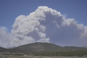
And in Virginia’s Shenandoah Valley, crews battling wildfires this week got an assist from some wet weather.
“Without a doubt the rain is helping,” said Cory Swift, a spokesperson for the Virginia Department of Forestry.